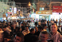
Thursday, April 7, 2011
There's no avoiding it

Tuesday, March 29, 2011
Everyone loves the Old City at night
It just so happens that I took a nearly-identical shot back in 2009. It was an interesting evening, as while I was setting up my tripod and composing the shot, a local kid was trying to beg money from me. Either my Arabic was off (which is entirely possible, as at the time my colloquial was virtually nonexistent), or the kid wasn't Palestinian (also possible, given that there was a nearby apartment building that looked to be all Jewish settlers), but we were having communication difficulties. Eventually the kid got through to me that he was willing to stick olives up his nose for money. I politely declined, but he stuck the olives up his nose anyway. And then, of course, he wanted money for the show.
I should've taken a picture of him and given him a NIS or two, just for fun.
In any case, in the spirit of friendly competition with the Living Jerusalem blog, here's another look at one of the images from that night. It's a HDR composite of several exposures, with some
additional tweaking in Photoshop:

Looking at the image I've produced, the colors are a bit unrealistic (though that's one of the styles you can achieve with HDR photography). In the end, though, I think that it's a fitting metaphor for Jerusalem. No one can be objective when it comes to Jerusalem (being something of a post-structuralist, I'd argue against the notion of 'objectivity' in regards to anything, but that's another story), and so our personal histories, biases, and preconceptions color how we look at Jerusalem, and many people end up idealizing it.
I am not immune to this tendency--I just spent a good long while compositing the HDR image, and then playing around with it in Photoshop, all to produce a 'perfect' snapshot of the Temple Mount. A snapshot that doesn't reflect the reality one would see when standing on the Mount of Olives and looking at this very same scene with her/his eyes.
Wednesday, September 16, 2009
The Judean Desert
I'll narrate the trip a little more through photos, but for some reason I decided to post them a bit out of sequence--like I said, I went to Manger Square after the Herodion, but the Church of the Nativity pictures are first up:
This is a 3-shot HDR composite of the inside of the Church of the Nativity. It was very busy, very crowded with tourists. Lots of Italians. On the wall in the upper left, and under the trapdoors in the floor on the lower left, are original mosaics dating back to Byzantine times, when the church was first built.

It wasn't just Italians. Poles & Germans, too. We're lucky World War I didn't break out. Anyway, this is the grotto under the nave--the place where Jesus was born. The tourists were crowding the grotto, touching the stone, taking lots of pictures, and then this old Orthodox priest (you can see the black knit cap on his head just next to the blue banner) came down and started berating people for pushing and shoving and hogging the grotto.

Hiking to the Herodion means going through Bethlehem's eastern "suburb," Beit Sahour--where I got a big bottle of lemonade that was quite refreshing. Beit Sahour isn't very big, and you leave it with the Shepherd's Field to your left (and Har Homa looming over the Shepherd's Field), and pretty quickly, you're in the desert. The light was lousy, and, hey, it's a desert--so I didn't take any pictures for a couple miles, until I got to the highway. A little ways down the highway was this secondary road, leading to a Palestinian town. The sign indicates that this is part of the area where the Palestinian National Authority has sole authority and jurisdiction, and it's illegal for Israelis to enter. Illegal under Israeli law, that is--which is ironic, because traditional notions of sovereignty hinge on the territorial extent of a state's law. In other words, this is recognized as Palestinian territory (even by Israel), and yet Israel law is still active in this territory. Yet another example of political geography. Does that make your head hurt? So I followed this road, instead of the highway, to the Herodion.
Here's a panoramic view of the area (three photos stitched together). The greenhouses had a sign--a business for growing/selling flowers. Moments after I took this panorama, a car pulled up and the driver offered me a ride. He only spoke colloquial Arabic, so our conversation was stilted, and I've forgotten what he said the name of this village was. He took me about 4 miles, the rest of the way to the Herodion, and didn't expect anything in return. His name was Ibrahim.

Oops, I cheated a little. Ibrahim dropped me off at the Herodion, so this shot is actually one I took on the walk back. That big mound is the Herodion. I was hiking back along the main highway; the road I was walking on (and which Ibrahim drove me on) went up the lower hill, through the trees you can see on the right side.

Climbing up the Herodion, what did I see... but an Israeli military installation. Not very big, but with a tank and three APCs (armored personnel carriers), a couple watch towers, and lots of concertina wire, this little outpost looks down on the Palestinian valley directly east of Bethlehem. You can see Bethlehem in this picture, in the distance right above the tank's turret and gun. Nice of the Israelis to keep watch over Bethlehem like that, isn't it?

I climbed to the top of the mound. The Herodion is actually an Israeli National Park--all the more interesting, because it's not in Israel! 27 NIS (~$7.50) admission, not a penny of which goes back to the Palestinian communities that surround the place. I spun in a circle and took a bunch of photos, and here is a panoramic composite of three shots. There's a glitch in one stitch, and if you look closely at the roads, you'll see it. Anyway, this vista looks north from the Herodion. The curving road at the bottom of the shot is the one Ibrahim drove me on; the straight road about halfway up is the highway I hiked back on. The Dead Sea is off about 90 degrees to the right: you can't see the Sea from here, but you can see the haziness from the heat & humidity around it.

The top of the Herodion is actually quite boring--and that's saying something, coming from a guy who loves ancient history. The Herodion is very much like Masada in form and history--it was a hill-top fort, and it was held by the Maccabeans during the revolt against the Romans. The Romans eventually won, of course, and destroyed the fort. So there are ruins up there, but not a whole lot to look at. There are cisterns under the surface, though, and during the revolt, the Jews enlarged the cisterns and carved new tunnels and exits, in order to harass the besieging Romans. I went down there--lots of steep steps and low ceilings, but nice & cool--and took some pictures.

Here is an "emergency exit," but in ancient times, this was a secret hillside entrance used by the Jews to launch surprise attacks on the Romans. This is another three-exposure HDR composite.

The tunnels/cisterns were closed off just past this point, so I started hiking back to Bethlehem. I took the main road, with the intent of stopping a taxi or sherut (a minivan shared taxi) and riding back to town--it was just after noon, I was tired, and I felt like hiking 10 miles across the desert was good enough.
Not a single one stopped. And along the way, I stepped on a crumbling rock and took a spill, cutting my left hand and bruising up my left knee. The rest of the hike was uneventful--though I stopped and had a tasty lunch in Beit Sahour. The nice thing about the Bethlehem area is that Christian restaurants serve lunch during Ramadan. And I needed a good lunch after hiking 18 miles through the desert.
Behind the counter of the bar in this restaurant was a framed photo of Rachel Corrie, an American peace activist who was run over by an Israeli bulldozer that was demolishing Palestinian homes in Gaza in 2003. Two important bits to take away from this observation: first, the occupation of Palestine and Palestinian anger/resistance to the occupation isn't a simply a Jew vs. Muslim thing; there are a lot of Christian Palestinians who suffer the same indignities that Muslims do. Second, Israel evacuated all the Jewish settlers from Gaza in August of 2005, 2 1/2 years after Rachel Corrie was killed. The IDF bulldozed all the Israeli settlements, rather than let Palestinians move into the homes.
Tuesday, September 1, 2009
Al Amari
On Saturday, several of us from the guest house (there are a bunch of Birzeit University students living here, including some Americans, Europeans, and an Aussie who are studying Arabic) went to the center of town to meet up with the director of an NGO (non-governmental organization) that teaches English to Palestinian kids in the Al-Amari refugee camp. The Birzeit students are here for three months or more, and so wanted to volunteer. I was tagging along to volunteer and/or observe and/or make another contact in the NGO community; schooling in the camps is by and large left to the United Nations.
So we got to the designated meeting place, and after 15 minutes or so of waiting, we called to find out why the director hadn't met us. Well, it was Ramadan, and because this woman hadn't heard back from Birzeit that anyone would be volunteering, she had canceled everything. The Birzeit students are going to wait until after Ramadan and try again—during Ramadan, they do the English lessons in the morning, and that's when Birzeit has its classes.
But some of us (well, me and anyone who felt like following) weren't deterred. I had never been to an honest-to-goodness refugee camp, and so I decided to walk down to the camp to take a look around. To give you a very, very brief background, these are "camps" in only a very loose sense. Most of the refugee camps in Palestine go back to the 1948 War of Independence (called an nakba, "The Catastrophe," by Palestinians), when Palestinians fled the fighting in the North and West and took refuge in safer areas. The camps around Ram'allah are populated by Palestinians who lived in/near Jerusalem or Tel Aviv. The camps aren't collections of tents; for 60 years now, Palestinians have been building houses out of whatever materials they can get, and there is some very basic infrastructure (electricity, running water) that has developed over the years. Ultimately, the camps have the look of run-down, low-income areas. Some (rabid pro-Israelis) have a problem calling the residents of these areas "refugees," as the United Nations has an entire arm of the organization dedicated to providing services to the refugees (the United Nations Relief Works Agency, or UNRWA), and there is some semblance of infrastructure present. But the bottom line is that these camps aren’t recognized as legal residences, and the homes and shops are built on land that someone else owns.
I could write a lot more about the camps, but this was supposed to be a brief narrative. So I’ll get back to that.
Having walked around most of Ram’allah, relying on my geographer’s acute recall of the map back in my room, and periodically consulting my trusty keychain compass, I was able to navigate the 1.5 kilometers or so from the city center to the Al Amari camp. And, as promised, it was distinguished by two things: the generally run-down and low-income look of the area, and the UNRWA buildings. We—an American undergrad, a British Cambridge grad, two Germans, and me—walked through the camp, which was pretty quiet. The locals we passed treated us pretty much like all the other Palestinians we’ve met—a nod and a smile, a quick greeting, sometimes a curious stare—until we hit the “main street” cutting east/west through the camp. An older gentleman—probably in his 70s, wearing a kuffiyeh—greeted us, and started up a conversation with the American undergrad and the Briton. This Palestinian asked where they were from. Upon hearing “America,” the gentleman didn’t have any problem; but when the British woman told him where she was from, he got a little animated.
“This… Palestine is my land. Jews came and took from me! Britain… Balfour let them!”
He was referring to the Balfour Declaration of 1917, wherein the British “government view[ed] with favour the establishment in Palestine of a national home for the Jewish people.” The British were in charge of the Mandate of Palestine, and so this was widely seen as the opening of the gates for European Jewish immigration to the region, the fulfillment of the Zionist dream. Of course, most everyone forgets the rest of the Declaration: “it being clearly understood that nothing shall be done which may prejudice the civil and religious rights of existing non-Jewish communities in Palestine.”
It was rather ironic to me, though; the guy gave a pass to America, despite widespread Arab/Muslim resentment of unflinching U.S. support for Israel (not to mention well over a hundred billion dollars in U.S. aid), but he blamed the British for starting the whole chain of events that led to him living in a refugee camp for the past 61 years. Of course, he wasn’t blaming a 22 year-old British woman for a government policy enacted 82 years ago, and he certainly wasn’t hostile. But it just goes to show that there are deep histories and long memories in the Israel/Palestine dispute, and no simple answers.
Enough narrative! Time for pictures:
Shortly after sunset the first weekend of Ramadan, looking west-southwest from the roof of the guest house. You can just make out the Israeli city of Rehovot as a line of lights on the horizon below the center of the frame. Less than 10 miles beyond Rehovot is the Mediterranean.

Hey, remember this billboard from Ram'allah? They've got 'em in Bethlehem, too. This one is on top of an apartment building, just north of the old city.
Another one of the USAID billboards, attached to a building housing, among other things, a bank. About ~500 meters beyond this building is the old city of Bethlehem and Manger Square.
A bit further on, looking back northeast. This billboard is attached to a building that has an honest-to-goodness parking garage (first one I've seen in Palestine).
After leaving Bethlehem to the southeast, looking back towards the old city & Manger Square. This trio of billboards not only trumpets USAID success in training health care workers, but also advertises a radio station(?) and ice cream. I'm guessing on the center billboard, because it says something like "we had for two years the wide 5:00 capacity with...[something I can't figure out]." So it seems to be advertising a TV/radio station having the biggest evening audience for two years. Michael, help?
Leaving Bethlehem behind, going southwest along a highway, I hiked through the Judean Desert (more in a subsequent post). I turned off the highway to follow this road, which had this very fascinating marker denoting an area of Palestinian sovereignty. I find it fascinating that it's against Israeli law for Israelis to go somewhere that (by definition) isn't in Israel. If you ever wonder what political geography is, it's stuff like this...
...And it's also stuff like this. This is the Har Homa settlement, which houses 15-17,000 Israelis on land seized from Palestinians during the 1967 Six-Day War. I have more photos that show more detail that I'll post later, but in the far right side of the frame you can see the construction cranes that are adding onto the settlement. This is part of the "natural growth" of settlements (despite them being illegally-located on Palestinian land in the first place) that the Israeli government refuses to stop. Har Homa, and settlements like it, are the big reason for the Security Barrier, and these settlements are choking off Palestinian communities like Bethlehem. Oh, I should probably mention this photo was taken from the east end of Bethlehem, and the low ground in the frame is the famed "Shepherd's Valley," where according to the Bible, the angels proclaimed the birth of Jesus to shepherds tending their flocks. The settlement, with its multiple schools, shopping centers, and medical clinics, is considered by Israel to be part of Jerusalem.

Monday, August 24, 2009
Leila
To clear a common misconception: this is not the desert. There are deserts to the south (the Judean Desert, the Negev, the Sinai); there are deserts to the east (the Jordan Desert and the Southern Desert); but technically, most of Israel/Palestine--particularly the coastal and highland areas--is a "Mediterranean" climate. This means hot, dry summers and cool winters, with most of the precipitation coming during the winter months. Los Angeles has a Mediterranean climate.
There's plenty of greenery mixed in with the reddish-brown dirt on the hillsides--olive trees and other herbaceous shrubs that are used to long, dry summers. The days can get hot; if you've been looking at the weather applet off to the right, you'll note that the daily high temperature is in the high-80s to mid-90s--but as "they" say, it's a dry heat: the humidity is typically low in the daytime. Ram'allah is in the hill country, about 2900 ft above sea level, less than 40 miles east of the coast. The proximity to a large body of water moderates the regional climate--that is, it stays cooler in the day (and summer) and warmer at night (and winter) around here than it would if the sea weren't so close. Also, every 1000 feet of elevation corresponds to a 2 degree (Farenheit) temperature decrease--so it's cooler up on the hilltop than down in the valley.
So that gives you a sense of the physical geography of the area. What does this mean--and what does it have to do with the night? Most of the nights I've been here, a couple hours after sunset as the temperatures drop and prevailing winds off the Mediterranean push moist air inland, a thick blanket of fog rolls east. As the moist air is forced upward by the hills, it cools and the fog thickens. The hills and valleys are breezy most days and nights, and so standing on the roof of the guest house, several nights now I've watched the fog roll in and over Ram'allah... only to push further east, towards Jericho (of course, Jericho is in the lowlands around the Dead Sea, so it's warmer there, and it's likely the fog dissipates in the warmer air on the other side of the hills). Some thin tendrils of fog linger in the valleys, though, shadowy and cool until the morning sun climbs high enough to burn the shreds away.
If you time it right, then, you can witness this cool, damp blanket being dragged eastward, and watch the lights of Ram'allah change from pinpricks of brightness to fuzzy technicolor orbs.
And last night after the fog rolled through, the crescent moon fell slowly into the sea; from the apartment building just across the street, some Ramadan revelers played Louis Armstrong's What a Wonderful World several times, loud enough for the entire neighborhood to hear and enjoy.
Looking northwest from the roof of the guest house, towards the "suburb" of At-Tireh, with the old Byzantine church, At-Tira mosque and the UNRWA (United Nations Relief Works Agency) compound making the fog glow.

Sunday, August 23, 2009
Saba'h, Shabbat, Sabbath
As a result, it's hard to get anything done in Palestine from Friday to Sunday. The NGOs (non-governmental organizations) and municipal offices I'm trying to work with basically all have 4-day work weeks. Throw Ramadan into this tangled mess of religious observance, and it gets harder to get any work done--Muslims get up before dawn to have breakfast, and then often go back to bed to sleep part of the day away, and things s l o w d o w n q u i t e a b i t . . .
So while I'm waiting for my contacts to get back to me, I've been walking around town, taking pictures of stuff. There are lots of buildings and projects with signs on them, attributing the construction, addition, or renovation to some international donor. It is in this context that USAID is marketing its projects quite heavily--as you can see below.
First off, a "typical" street view just east of the center of Ram'allah. This is looking west along An-Nahda Street. The radio station you see advertised on the billboard runs programming partially funded by USAID.

This is facing the other direction from the previous shot--looking east. In the distance, you can see another billboard advertising a USAID program.

A bit closer, you can see it's the same program from the billboard I photographed earlier, over to the northeast near where I'm living--it's advertising USAID-funded programs to train health care workers.

A bit further east, towards the wealthier part of town, this billboard advertises another program. The caption reads:
Step by step
We rebuild and develop
Empowering more than 2000 youth leaders
From the American people (United States Agency for International Development)

There are two interesting things about this particular advertisement. First, the word for "empowering" (or "empowerment") is tamkeen--which is also the name of a specific aid project that aims to inculcate Arabs to Western norms of secular, civil society--through programs like coloring books for children, radio and television programs with strong women characters, education, etc. Second, this billboard seems to indicate that "empowering young leaders" has something to do with the media. In case you were wondering, the Tamkeen project is one of the "fall-back" programs in my research (meaning, it's big and widespread and ongoing, and is a bit too big for me to take on at the moment--but if I can't get any traction on my main project, this is what I'll dig into).
Tuesday, August 18, 2009
Useful phrases
sishtarayu mobile phone; wayn dukan mobile? I will be buying a mobile phone--where is the mobile store?
la, uhibb batla ma'ee kabeer. No, I would like the big bottle of water.
mahaaratuka al-lughat ul-inklizieh akbar min mahaaratee al-lughat ul-arabieh. Your English is better than my Arabic.
I remembered that I'm a geographer, and we use maps--so I found a bookstore and bought a map of Ram'allah. Unfortunately, the road I'm looking for isn't on the map.
I broke down and bought a cell phone for use over here. It was more than I wanted (my grant) to spend, but I have to face reality that phone calls get more responses than e-mails.
After not being able to find the NGO office I'm looking for, I stopped at maTa'm meester beetsa (Mr. Pizza's Restaurant) for... well, even though the pizza looked good, it was way too much food for me to eat in one sitting, and I didn't want to carry a pizza box 2 miles back to the guest house, so I got a hamburger instead. It wasn't all that bad, and the guy working the counter came out and started talking with me in English--turns out he lived in Florida and Chicago. As he was talking to me, a friend of his walked up, his hands filthy with dirt and grease, and he started complaining (in English) about having a flat tire. Not only did I get lunch, but the (restaurant) guy gave me his business card and offered to help me with my work.
Some photos of Ram'allah:
This is a ~120-degree panorama from the roof of the guesthouse, looking west-southwest right after sunset. I stitched four photos together to get the panorama, and messed up one of the joins (laptop monitor is too small to see one issue until it was too late). The center of Ram'allah is off to the east-southeast, so almost directly left from this view.
This billboard is about 100 yards from the guest house. This side says:
Step by step
We rebuild and we develop
Training 12,000 health service providers
From the American people (United States Agency for International Development)
This side says:
Step by step
We rebuild and we develop
Build and repair more than 6100 classrooms
From the American people (United States Agency for International Development)

There's another one of these billboards over on the other side of town, over by a school with USAID logos all over it--the school has an astroturf soccer field, too.
Monday, August 17, 2009
Ram'allah: under construction
All that said, it's an interesting place. It's very hilly, and so walking just about any distance means going up/downhill as much as 150 meters. The hills that aren't full of big, expensive houses or spiffy apartment buildings are terraced olive-tree groves, and in the morning a chilly fog rolls up out of the valleys and is burned off by 8am or so. All in all, it's a pretty peaceful place.
Except that everyone is busy, and one word exemplifies the place: construction. I got a little lost my first day walking around, because the street that I should've been walking on was so torn up (they're re-trenching sewer lines) I thought it wasn't even a street. There are high-rise office & apartment buildings being built, and though there is plenty of the type of trash you expect to see accumulating around a developing-world countryside, there is a lot of construction rubble, too (i.e., cinder blocks, chunks of re-bar, tile, etc.). Right now I hear a little yap-dog down the street barking its little yap-dog head off (this is a Christian area), and then in the distance I hear bulldozers, dump trucks, and jackhammers. Last night, after sunset, I heard someone using a masonry saw down the street.
The people of Ram'allah strike a stark contrast to those people in other places I've been to; here, everyone is either shopping (in the center of town), making something, or going somewhere. In Damascus, there were lots of people just hanging out--as if they were waiting for something to do. In Jerusalem, it was similar, except the waiting was "waiting for tourists." In Istanbul, people were scheming and scamming and going places--but everything had already been built. Amman was full of people who seemed to have nothing to do, too. I could go on, but instead of belaboring the point, I'll just sum up by saying: Ram'allah is moving, and its people are industrious.
A couple other observations about the place: one, you can't go very far without passing a Palestinian government office, a UN compound, or some international aid organization project--Ram'allah is certainly the nexus of Palestinian development. Two, security is pretty tight. At major intersections, and every couple hundred yards near the center of town, is a soldier in camouflage and beret, holding an AK-47 at the ready. The soldiers are friendly, though. When I was out this morning, a few struck up a conversation with me, and seemed most impressed that the population of Chicago was about the size of the population of all of the West Bank.
More later, but for now I'll share a few leftover pictures from the other side of the wall:
P.S. my internet connection here at the guest house is woefully slow, so I'm using a different format for the pictures that results in a smaller file--at the cost of lower image quality. If you like any of the pictures and want better reproductions, let me know and when I get back I can get you full-resolution copies.
One last photo of the Dome of the Rock, at night.

Early morning in the Garden of Gethsemane. This is one of the 2000+ year-old olive trees.

Lots of flowers & flowering vines in the Garden. Took a quick shot of these viney flowers, and spiffed up the shot using the Viveza plug-in for Photoshop.

16 NIS ($5) gets you a ticket to walk all around the Old City of Jerusalem on top of the city walls. This was the view on the South Ramparts walk near sunset; south of the Old City is the Franciscan Monastery, and at sunset it made a very pretty sight. This is a 3-photo HDR composite of the scene.

A little further along the South Ramparts, there's an unobstructed view of the terrain to the south. Bethlehem (Bayt Laham) is just a few miles south of Jerusalem--that's it on the hilltop in the background of this shot.

Here's a zoom/crop of that prior photo, focused tightly on the hilltop & Bethlehem. You can see the security barrier (aka "Apartheid Wall") snaking over the landscape. The Israelis built the wall in this area because of the continued building & expansion of Israeli settlements on Palestinian land in the West Bank.

The South Ramparts wall-walk ends right next to the Western Wall plaza, and so I cut through there on my way back to the Mount of Olives. As I've mentioned previously, when Israel captured the Old City in the Six Days' War in 1967, there were apartment buildings standing here. The Palestinian residents of those homes were evicted and the buildings bulldozed to make the plaza. On this evening, there was some sort of IDF induction ceremony being held, with a bunch of new recruits standing at attention.

The officer in charge--the woman near the center of the frame--was pacing back and forth, giving some sort of lecture in Hebrew. The guy to the left of center was translating into English for the non-Hebrew speakers in the crowd. It was some rambling speech about how much of an honor it was to hold the ceremony here, and how important this place was to Israelis. It made me wonder what Palestinian Muslims--whose homes had been bulldozed on this very spot, just 50 yards or so from the Haram ash-Sharif and one of the holiest places in Islam--might think about the military ceremony being held there.

Wednesday, August 12, 2009
The Muzzein Belched
Keeping on the religious topic, I visited places holy to the three great monotheistic religions. The Western Wall (aka the 'Wailing Wall') of the Second Temple, the holiest place for Jews--though technically, the Temple Mount itself is holier... but Jews are forbidden to go there. Or so I thought, as when I visited the Temple Mount, there were some IDF soldiers up there. The books I have read on the subject have misinformed me.
As I just noted, I went up to the Temple Mount--or, to Muslims, the Haram ash-Sharif (the 'Noble Sanctuary')--site of the Al Aqsa Mosque (mentioned in the Qur'an), and the Dome of the Rock. The Rock in the Dome is believed by Jews to be the stone upon which Abraham was prepared to sacrifice his son to prove his dedication to God. To Muslims, Abraham was in Arabia for this event, and the Rock in the Dome is instead the point from which Muhammad ascended to heaven. All in all, a pretty holy place--the site of the Second Temple of the Jews, and the third-holiest site in Islam.
But wait--there's more holiness! On the way to the Temple Mount and the Western Wall, I stopped at the Garden of Gethsemane, which according to Christian tradition, is where Jesus spent the last night before his crucifixion. There are olive trees in the Garden, several of which have been scientifically dated to be more than 2000 years old. I took pictures of them (and will post them later). Is that enough holiness for you? Because there's more!
I also went to the Church of the Holy Sepulcher--the church built (by the Emperor Constantine's mother) on Golgatha (where Christ was crucified), and containing the crypt where Jesus was interred.
I had some very tasty Armenian food for lunch, too.
I mentioned yesterday that I'd post more about politics, but I spent way too much time working on some of these photos for posting, and so you're just going to have to wait for more political ranting.
The pictures are in reverse-order of how I should've loaded them, and I'm not going to mess with moving stuff, as the last time I tried that, the blog crashed.
First up, the rotunda inside the Church of the Holy Sepulcher. This isn't a HDR composite--just a regular shot with very little post-processing. I love my IS lens: I hand-held a 1/5 second exposure and it's sharp as a tack.
Next, a hallway in the back of the church. This is a HDR composite of two images--the third was too long of an exposure for even the image stabilizer to keep steady (2.5 seconds). Honestly, I don't think it needs the third.

This is in the front-ish of the church, near the shrine to the left of the entrance. This frescoe is from the Byzantine era. In the right of the frame, you can see the people lining up to go into the shrine. I got berated by a priest for wearing a hat inside; I guess it's OK to wear a hat if you're standing in line for the shrine? This is another 2-shot HDR composite.

This is looking back towards the entrance. This is a 3-shot HDR composite, which results in "ghosting" of multiple images of the same person as they move through the three exposures.

This shot is in basically the same location, but rotated 180 degrees--so this is the view directly behind where I was standing in the last shot. It's a 3-exposure composite HDR image, but the light streaks were not added--it was pretty smoky inside, due to all the votives and tapers that were burning. This is one of my favorite images from the trip so far, if I do say so myself.

This is "extreme close-up" detail on the Dome of the Rock, so you can see all the calligraphy and tile work. The larger image is below.

The entire image of the Dome of the Rock. This is a single exposure--not HDR--but I did some considerable tweaking (correcting the perspective, saturating the blue sky) to make the image more vivid--the light was pretty harsh when I took the picture. If you look closely, you can see the moon right next to the dome (if the dome was a clock face, look at about 2:00).
Monday (alternatively, "This Land is Not Your Land")
OK, blogspot is a pain in the neck for posting pictures, and when I tried to publish my last post, it lost the whole thing--pictures, text, and all. This annoyed me greatly, because I had spent a good amount of time writing up that post.
So I'm going to compose stuff offline, and then try to upload it later. If it doesn't work, I'll just go back to the livejournal blog I used in Damascus three years ago.
Here's my attempt at the post that blogspot vaporized.
Time is flying by, and I'm not getting stuff posted as quickly as I'd like. Of course, having taken over 300 photos so far is slowing me down--spending a few minutes editing each picture takes some time. But in someways, this is a good thing. After walking around on Monday, I saw somethings that got me really riled up, and had I posted to this blog right away, it probably would've come across as an angry political rant.
Instead, I've had some time to cool down, and reflect. So this won't be as emotionally-charged as it could have been. But to the point--Monday I took a long tour around Jerusalem. I saw lots of ancient buildings, religious landmarks, and Palestinians being routinely abused in a casual, careless way by Israelis. A few 'narrative' snapshots, followed by some photographic ones:
In the morning, I took a bus tour around Jerusalem. You get on the bus for the two-hour loop around the city, and they give you a pair of headphones you can plug in, to listen to a pre-recorded narration of the various points of interest--in your choice of eight different languages. The thing that struck me most about the narration was the complete erasure of Palestinians from the landscape. The narration at various points discussed cooperation and peace between Christians, Jews, and Muslims, but never once did it mention Palestinians. Landmarks were noted as places captured by valiant IDF soldiers, or places where Arabs (or Jordanians) committed some murderous crime against peace-loving Jews/Israelis. A plot of land outside the Old City, purchased by a Jewish immigrant during the British Mandate period, was mentioned as the first site of Jewish residence outside of the Old City--but it was never mentioned that the Jew had purchased the land from its Palestinian owner. Over and over again, the presence of Palestinians was elided. The narrative established Jews/Israelis as heroic conquerors or liberators or entrepreneurs, and enemy Arab/Jordanian forces as the bad guys. But Palestinians? They didn't exist. I was tempted to switch to the Arabic version of the narration to hear how that represented things. The bus tour was very unfulfilling. There's that old saying about how history is written by the conquerors... I guess tour bus narration is the same way.
After the bus tour, I was walking through the David St. Market in the Old City, and I saw a Palestinian merchant being accosted by a trio of Israelis. Two of the Israelis were IDF soldiers, with automatic weapons and body armor; the third was an Israeli police commander--also with an automatic weapon and body armor. I wasn't entirely sure of what the dispute was, but it seemed that when the Palestinian had left for afternoon prayers, he had left something--trash, I'm guessing--outside his shuttered stall, and this apparently warranted the intervention by three heavily-armed Israelis to set this shopkeeper right.
Later, I saw this same trio outside another Palestinian merchant's stall--they were giving him a hard time because some of the scarves he had hanging up outside his store were low enough that a tall man might brush his head against the scarves as he walked past. Apparently, hanging your merchandise a few inches too low merits an angry berating from armed Israelis.
Then in a suq in another part of the Old City, I walked past an escalating argument between a Palestinian merchant (running some sort of clothing/tailor shop) and some IDF soldiers. Whatever the dispute was, an IDF officer had just gotten there as I was passing, and was intervening--on the soldiers' behalf, of course. I surreptitiously snapped a picture of the scene.
As my day was winding down and I was tiring out, I headed back to my hotel, going the long way around the city walls, through East Jerusalem. The Damascus Gate leads from the Old City to East Jerusalem (the Palestinian area of the metropolitan area), and outside the Gate is a taxi stand. As you progress east from the taxi stand, there are signs along the road that are either "no parking" or "no taxi idling" type of signs, and as I was walking along one of these areas, there were plenty of taxis pulled up alongside the roadside, looking for fares. Suddenly a teenager yells something in Arabic--all I caught was "yalla! yalla!" ("go! go!")--and a young Palestinian guy goes running past me and jumps into one of the parked cabs, quickly starting it up and trying to drive away. A white pickup truck with three Israeli police screeches up and boxes in the taxi. The driver tried to sneak the taxi past the truck, but an Israeli cop jumps out of the pickup and starts pointing and yelling at the driver, and then puts his hand on the pistol on his hip. The incident ended with the cops pulling the taxi driver out of the cab and taking him off to the side to write up some paperwork--a ticket, or a court summons. Again, I took some surreptitious pictures, but at the same time, there was an older tourist with a digital camera, brazenly taking pictures of the whole incident from just a few feet away. The Israeli cops didn't seem to care. They got their man: the parking ticket was issued and order was restored to East Jerusalem.
So I didn't go looking for it, but I got a very clear picture of what life can be like for Palestinians in Israel. The Israelis have the power and the guns, and I saw several exercises in authority that seemed quite arbitrary and petty. From the merchants whose zoning infractions were addressed by rifle-wielding soldiers, to the taxi driver who was nearly pulled from his cab at gunpoint for a parking ticket, to the erasure of Palestinian presence from narratives about Jerusalem's environs, it was pretty disturbing.
Sadly, the political realities stayed in my face the next day--which I'll post about tomorrow. Right now I've got to try to get this to work on blogspot. Pictures & captions below.
The Russian Orthodox church on the slopes of the Mount of Olives. This is a HDR (high dyanmic range) composite of three separate exposures.
![]() |
From An American Geographer... |
This is the inside of the Zion Gate on the south side of the Old City. The only post-production manipulation was my (partially successful) attempt to straighten out the perspective issues from shooting wide-angle--the woman in the foreground was sitting very still, so that the 1/15th-second exposure left her really sharp and distinct, while the woman walking through the arch was blurred. Kinda cool, eh?
![]() |
From An American Geographer... |
Looking east from the Jaffa Gate, into the David St. Market. No post-processing other than some minor contrast/brightness tweaks
![]() |
From An American Geographer... |
The Western Wall. Another HDR composite of three exposures, to bring out the details in the sky and the colors in the wall. The "ghosting" produced by compositing three images with moving people is intentional. Before Israel took this part of Jerusalem in the 1967 Six Days' War, this entire area was Palestinian apartment buildings. The Israelis bulldozed the apartments to make the plaza.
![]() |
From An American Geographer... |
Another view of the Western Wall and the plaza. The golden dome in the background is the top of the Dome of the Rock--the third holiest site in Islam--and the wooden walkway is the Bab al-Maghariba, the entrance for non-Muslims to access the Temple Mount / Haram ash-Sharif.
![]() |
From An American Geographer... |
"This is Not Your Land" (part one). The IDF soldiers were arguing with the Palestinian merchant, and more IDF were coming to back them up in the argument. I snapped this picture from the hip, not wanting to draw attention to myself and make anything worse.
![]() |
From An American Geographer... |
"This is Not Your Land" (part two). Another quick shot of Palestinians at the mercy of the Israelis with guns. I didn't need to be so circumspect--another guy was openly taking pictures and the Israeli police didn't seem to care at all.
![]() |
From An American Geographer... |
P.S. Let me know if the pictures don't come through. I did something weird, and am hoping it works.