
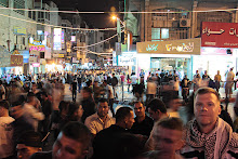
I'll narrate the trip a little more through photos, but for some reason I decided to post them a bit out of sequence--like I said, I went to Manger Square after the Herodion, but the Church of the Nativity pictures are first up:
This is a 3-shot HDR composite of the inside of the Church of the Nativity. It was very busy, very crowded with tourists. Lots of Italians. On the wall in the upper left, and under the trapdoors in the floor on the lower left, are original mosaics dating back to Byzantine times, when the church was first built.

It wasn't just Italians. Poles & Germans, too. We're lucky World War I didn't break out. Anyway, this is the grotto under the nave--the place where Jesus was born. The tourists were crowding the grotto, touching the stone, taking lots of pictures, and then this old Orthodox priest (you can see the black knit cap on his head just next to the blue banner) came down and started berating people for pushing and shoving and hogging the grotto.

Hiking to the Herodion means going through Bethlehem's eastern "suburb," Beit Sahour--where I got a big bottle of lemonade that was quite refreshing. Beit Sahour isn't very big, and you leave it with the Shepherd's Field to your left (and Har Homa looming over the Shepherd's Field), and pretty quickly, you're in the desert. The light was lousy, and, hey, it's a desert--so I didn't take any pictures for a couple miles, until I got to the highway. A little ways down the highway was this secondary road, leading to a Palestinian town. The sign indicates that this is part of the area where the Palestinian National Authority has sole authority and jurisdiction, and it's illegal for Israelis to enter. Illegal under Israeli law, that is--which is ironic, because traditional notions of sovereignty hinge on the territorial extent of a state's law. In other words, this is recognized as Palestinian territory (even by Israel), and yet Israel law is still active in this territory. Yet another example of political geography. Does that make your head hurt? So I followed this road, instead of the highway, to the Herodion.

Here's a panoramic view of the area (three photos stitched together). The greenhouses had a sign--a business for growing/selling flowers. Moments after I took this panorama, a car pulled up and the driver offered me a ride. He only spoke colloquial Arabic, so our conversation was stilted, and I've forgotten what he said the name of this village was. He took me about 4 miles, the rest of the way to the Herodion, and didn't expect anything in return. His name was Ibrahim.

Oops, I cheated a little. Ibrahim dropped me off at the Herodion, so this shot is actually one I took on the walk back. That big mound is the Herodion. I was hiking back along the main highway; the road I was walking on (and which Ibrahim drove me on) went up the lower hill, through the trees you can see on the right side.

Climbing up the Herodion, what did I see... but an Israeli military installation. Not very big, but with a tank and three APCs (armored personnel carriers), a couple watch towers, and lots of concertina wire, this little outpost looks down on the Palestinian valley directly east of Bethlehem. You can see Bethlehem in this picture, in the distance right above the tank's turret and gun. Nice of the Israelis to keep watch over Bethlehem like that, isn't it?

I climbed to the top of the mound. The Herodion is actually an Israeli National Park--all the more interesting, because it's not in Israel! 27 NIS (~$7.50) admission, not a penny of which goes back to the Palestinian communities that surround the place. I spun in a circle and took a bunch of photos, and here is a panoramic composite of three shots. There's a glitch in one stitch, and if you look closely at the roads, you'll see it. Anyway, this vista looks north from the Herodion. The curving road at the bottom of the shot is the one Ibrahim drove me on; the straight road about halfway up is the highway I hiked back on. The Dead Sea is off about 90 degrees to the right: you can't see the Sea from here, but you can see the haziness from the heat & humidity around it.

The top of the Herodion is actually quite boring--and that's saying something, coming from a guy who loves ancient history. The Herodion is very much like Masada in form and history--it was a hill-top fort, and it was held by the Maccabeans during the revolt against the Romans. The Romans eventually won, of course, and destroyed the fort. So there are ruins up there, but not a whole lot to look at. There are cisterns under the surface, though, and during the revolt, the Jews enlarged the cisterns and carved new tunnels and exits, in order to harass the besieging Romans. I went down there--lots of steep steps and low ceilings, but nice & cool--and took some pictures.

Here is an "emergency exit," but in ancient times, this was a secret hillside entrance used by the Jews to launch surprise attacks on the Romans. This is another three-exposure HDR composite.

The tunnels/cisterns were closed off just past this point, so I started hiking back to Bethlehem. I took the main road, with the intent of stopping a taxi or sherut (a minivan shared taxi) and riding back to town--it was just after noon, I was tired, and I felt like hiking 10 miles across the desert was good enough.
Not a single one stopped. And along the way, I stepped on a crumbling rock and took a spill, cutting my left hand and bruising up my left knee. The rest of the hike was uneventful--though I stopped and had a tasty lunch in Beit Sahour. The nice thing about the Bethlehem area is that Christian restaurants serve lunch during Ramadan. And I needed a good lunch after hiking 18 miles through the desert.
Behind the counter of the bar in this restaurant was a framed photo of Rachel Corrie, an American peace activist who was run over by an Israeli bulldozer that was demolishing Palestinian homes in Gaza in 2003. Two important bits to take away from this observation: first, the occupation of Palestine and Palestinian anger/resistance to the occupation isn't a simply a Jew vs. Muslim thing; there are a lot of Christian Palestinians who suffer the same indignities that Muslims do. Second, Israel evacuated all the Jewish settlers from Gaza in August of 2005, 2 1/2 years after Rachel Corrie was killed. The IDF bulldozed all the Israeli settlements, rather than let Palestinians move into the homes.
No comments:
Post a Comment